
Lafayette Neighbors: A Block-Level Coverage Map
A block lookup works best when each source is assigned one role. Boulder County Property Search connects an address to a parcel and assessed owner. County and city GIS layers show how parcels, roads, address points, city limits, and civic geography sit together. Voter reports can show some registered voters at a residential address. Associations and public boards add community and civic context, while historical directories and cemetery records can explain how a block changed.
These records do not create a complete Lafayette neighbor roster. An owner may receive mail elsewhere, a household member may not appear in a public report, and a protected voter may be omitted. The table separates the immediate-block tools from the community layer so a name or address is not given more meaning than the source supports.
| Source | What It Shows About a Block | Access |
|---|---|---|
| Assessor Property Search | Parcel-by-parcel assessed owner, mailing address, legal description, value, and characteristics | Free county search |
| Boulder County GIS | Adjacent parcels, roads, address ranges, precincts, zoning, flood, open-space, and land-use context | Public map and data layers |
| City of Lafayette ArcGIS | Lafayette parcels, address points, city limits, streets, and neighborhood-overlay geometry | Public hosted layer catalog |
| Voter report | Public residential or mailing address, status, precinct, birth year, party and date fields where available | Download or request from Elections |
| Recorder | Ownership-transfer sequence for selected parcels, plus liens, plats, and related recorded instruments | Online index and Recording Division |
| Historical directories | Older occupants, businesses, street context, and address changes | Library and Carnegie channels; Lafayette years stated as 1892-1978 |
| Neighborhood associations | Community boundaries, meetings, newsletters, directories, preservation, and social contacts | Public association pages; no complete roster located |
| City boards and committees | Public civic participants, agendas, minutes, and eligibility information | City page and public meeting records |
| History and cemetery records | People, organizations, burials, and neighborhood memory tied to local history | Library, museum, archives, and Clerk request routes |
For immediate Lafayette neighbors, begin with the target parcel and the parcels that touch or face it. Add voter and association information only after the map relationship is clear. A full named-street chain belongs to a street-by-street search, not to an assumption that everyone nearby is part of one household.
Note: A block lookup is strongest when the map relationship, parcel identifier, record date, and custodian are written beside each result.
Lafayette Neighbor Parcels: Click Outward
The adjacent-parcel method starts with a known address and walks outward visually. Boulder County Property Search lets a searcher locate the target, zoom the map, and click a parcel. City ArcGIS layers can add address points, roads, and city limits. There is no documented county radius or measure control that produces a ready-made neighbor list, so the method should state exactly which boundaries were clicked.
Keep an address point and a legal description beside each map result. That record prevents a similar street name, a neighboring mailing city, or a parcel across a jurisdiction line from being folded into the Lafayette block by mistake.
- Locate the target address in Property Search and save its owner, account number, parcel number, legal description, situs, and mailing address.
- Zoom and pan along the block, then click parcels that share a boundary or face the same segment. Use address points and streets to confirm the relationship.
- Check Lafayette city limits and roads before treating a nearby parcel as part of the same local block. A map can cross into Louisville, unincorporated Boulder County, or another mailing city.
- Open each adjacent parcel result and save owner, mailing address, legal description, neighborhood, and market-area fields without calling those fields a household list.
- Use the recorder only for a transfer or title question. For a whole named street, move to the Lafayette street-by-street records chain instead of expanding the block boundary by guesswork.
The flow is simple: address, parcel, adjacent map click, property record, then a separate public or community source. A precinct is election geography, not a block. A neighborhood overlay is civic context, not proof that every nearby address belongs to an association.
Lafayette Neighbor Records on a Property Card
The assessor result is the most direct public bridge from a Lafayette address to a named owner, but it remains a tax and property record. The official record can expose the physical address, account number, parcel number, legal description, lot size, estimated acres, subdivision, neighborhood, market area, owner, and mailing address. Dynamic sections may add value information and building characteristics.
Use those fields to match parcels, not to announce who lives inside. Ownership can sit with a trust, estate, business, or more than one person. A mailing address may be out of town. A value or year-built field describes property data and does not establish a person’s identity, household role, or daily presence.
| Address or situs | The physical parcel location used to anchor the block. |
|---|---|
| Account and parcel | County identifiers to carry into GIS, Treasurer, and recorder work. |
| Legal description | Lot, block, subdivision, or other land wording that helps distinguish adjoining parcels. |
| Owner | The assessed owner shown by the county record, which may be an entity, estate, trust, or multiple names. |
| Mailing address | The tax-mail destination, which can differ from the physical parcel address. |
| Neighborhood and market area | County classification and context, not a resident or association membership field. |
The assessor’s public route is online, with parcel questions at 303-441-3530 or assessor@bouldercounty.gov. A Tuesday Lafayette drop box or branch route is listed at 1755 S Public Road. If the property record and the map disagree, preserve both results and ask the custodian about the parcel rather than filling the gap with a commercial address match.
Lafayette Neighbor GIS Layers
Boulder County GIS has supported county mapping since 1987. Public layers include parcels, roads and address ranges, precincts, zoning, floodplain, open space, land use, and other public-data context. County GIS guidance says parcel and precinct data are free, while update dates vary by dataset metadata. These layers help define where a block sits and which parcels touch it.
Lafayette’s hosted ArcGIS catalog adds public layers for `Lafayette_Parcels_Public_View`, `City_of_Lafayette_Address_Points_NG911_Public_View`, `Lafayette_City_Limits_View`, `Lafayette_Streets_View`, neighboring cities, zoning, land use, and the Old Town Neighborhood Overlay District. The city’s interactive zoning map is not the official zoning map under the notice described in the research. Planning and Building remains the proper route for official zoning questions.
- Parcel
- A mapped land unit that can carry a county account, legal description, and property result.
- Address point
- A mapped location used to place an address on a road or parcel; it is not a list of occupants.
- Precinct
- Election geography used for voting administration, not a guaranteed block or neighborhood boundary.
- City limit
- A jurisdiction line that can differ from a mailing city, ZIP boundary, or association area.
Pan, zoom, and identify controls are the documented map tools. No universal static GIS search form or one-click neighbor buffer was located. Save the map date, layer name, and parcel identifier so another researcher can retrace the same block method.
Note: A parcel layer can define adjacency, but it cannot turn a map boundary into a household roster.
The Lafayette No-Radius Lookup Caveat
A radius search sounds exact, but no official Boulder County page documented a dedicated radius or measure control for this work. Visual adjacency is the supported practical method: click the parcels sharing a boundary or facing the same block, then disclose that the result is based on map relationships. Do not turn a chosen distance into an official neighborhood boundary.
Two common shortcuts also fail. A Lafayette mailing ZIP does not prove city limits, and a property owner does not equal every occupant. The mailing city can follow postal geography while the parcel belongs to a different jurisdictional record. Confirm city limits, address points, roads, and parcel geometry in the county or city layers before labeling a nearby address a Lafayette neighbor.
Note: The strongest block result names the source, map layer, parcel relationship, and date instead of implying that the map captured every person nearby.
Insider tip. Save the parcel and legal description before testing a nearby name. A stable land identifier is easier to verify than a mailing ZIP, street spelling, or merged directory entry.
Public Voter Fields for Lafayette Neighbors
Boulder County Elections provides downloadable voter reports and statistics rather than a simple live address form. Standard reports do not require an account, and other data can be requested online. Where public, a report can contain a residential or mailing address, registration status, precinct, birth year, party affiliation and date fields. Phone, gender identity, and voting history may appear when the public field rules allow them.
Confidential voters and people using Colorado’s Address Confidentiality Program are omitted from ordinary public voter data. SSNs, driver-license or ID numbers, full birth dates, signatures, and email addresses are withheld under the cited election rules. A voter report cannot show ballot choice. It also cannot show every adult, child, guest, or other person at an address.
The Elections contact route is 1750 33rd St Suite 200, Boulder, vote@bouldercounty.gov, 303-413-7740, Monday through Thursday from 7:30 to 5, closed Friday. Use the county data-access route for the report and the registration route for registration questions. Keep the report date and field description with the parcel notes so a status change is not mistaken for a map change.
Highland Park’s Lafayette Neighbor Directory Tradition
Highland Park supplies a community layer that public parcel data cannot. The Highland Park Neighborhood Association was established in 1988 or 1989 and uses bi-monthly meetings, newsletters, and directories alongside improvement, preservation, and social work. Its history also points back to the first planned subdivision, platted in 1891. Those details explain why an association directory can add local context without becoming a complete public roster.
The first-party Highland Park history page is the right source for that association background and its public contact context. The capture below is tied to that page, not to an invented list of household names.
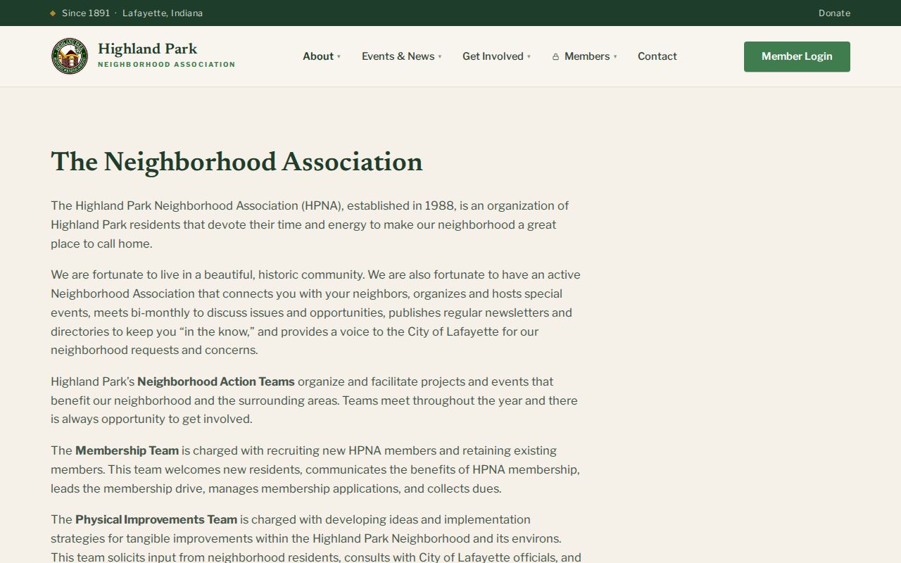
The image gives the block search a human scale: neighborhood identity is built through meetings, shared improvements, newsletters, and memory. It does not prove that every parcel in a map view belongs to Highland Park or that every association member lives on one chosen block.
Lafayette Neighbor Groups: Indian Peaks and Council
Indian Peaks operates as a master association with quarterly board meetings by Zoom and an email master list. The public contact layer can help a person understand how neighborhood communication works, but a public resident roster was not located. Treat meeting notices and association messages as community channels, not as evidence that a particular person lives at a parcel.
The Lafayette Homeowners Council supplies an umbrella view of neighborhood groups. Its listed communities include Carol Lane, Silver Springs, Silver Dell, Trails, Valley View Estates, Burton Valley, Andreasen Drive, and Sunnybrook. The names help sort a block into the right civic conversation, while the association’s public information should not be scraped into a personal address list.
Indian Peaks
Quarterly board meetings and an email list provide a public community contact route. No complete roster was located.
Homeowners Council
Neighborhood representatives and participating groups provide association context for Lafayette blocks.
Old Town Lafayette
The resident association and Garden Tour grants add preservation and civic context without publishing a full address directory.
When an association’s boundary is unclear, use its own public contact route and the city’s parcel or neighborhood layers. Association membership, meeting attendance, and newsletter receipt are not the same as property ownership or a verified residence.
Lafayette Neighbor Records in City Boards
City boards, commissions, and committees show a different kind of public people record. The City of Lafayette generally requires a resident to have lived in the city for at least 12 months and to be a registered voter, with youth exceptions described by the city. Recruitment commonly runs in August through September and March through April. Public member names, agendas, and minutes can place a person in a civic role without turning that role into a neighborhood roster.
The City boards and commissions page is the access route for current openings, member information, agendas, and minutes. A board appointment may help distinguish two people with similar names or connect a historic civic activity to a neighborhood, but it does not establish which parcel the person occupied or who else lived there.
Pair civic records with the parcel and date. An agenda can place a person in a public meeting, while a property card can name an owner, and a directory can supply a historic address. None of those sources alone answers the whole neighbor question.
What a Lafayette Neighbor Lookup Cannot Reveal
No public source located for Lafayette lists every person inside a home. Non-owner occupants and household members may never appear in the assessor roll or voter report. Protected voters and ACP participants are intentionally omitted from ordinary public data. Utility, delivery-customer, and DMV address records are restricted, and unlisted telephone information is not a normal block-research source.
Commercial neighbor-lookup tools may merge property, contact, and public-source categories, but a merged result can be stale, incomplete, or hard to verify. Official records have their own limits, yet they provide a visible custodian, a defined field set, and a path for checking the parcel, report, or document. The comparison is about source quality and scope, not about building a broader personal file.
| Source type | Useful strength | Important limit |
|---|---|---|
| County assessor and GIS | Named parcel, legal bridge, mailing clue, and map relationship | Owner is not every occupant; layers and values have update limits |
| County voter report | Public registered-voter fields, address, status, precinct, and selected dates | Confidential voters omitted; no ballot choice; not every household member |
| Recorder index | Dated transfers, grantor and grantee roles, liens, plats, and images | Ownership history is not an occupancy list; older coverage needs confirmation |
| Neighborhood association | Meetings, newsletters, directories, preservation, and community contacts | No public complete resident roster located |
| Commercial people-search category | May combine several public and commercial data points | Accuracy, source dates, and correction routes can be unclear; verify with the custodian |
Colorado’s Address Confidentiality Program provides a substitute address and mail forwarding for qualifying survivors of domestic violence, sexual offenses, and stalking. The program and confidential-voter rules are reasons a missing name or address should not be treated as a search failure. A lawful neighbor lookup respects those boundaries and uses the public block layer for orientation, not surveillance.
Lawful use. Lafayette neighbor research is for getting to know a block, reconnecting, civic participation, preservation, and personal safety awareness. Do not use a name, map, report, or association clue to stalk, harass, intimidate, or harm anyone.